← Back to Projects
Advanced Remote Sensing Class - Radar Displacement Map
Radar Displacement Map
By: Sahar Mohamed
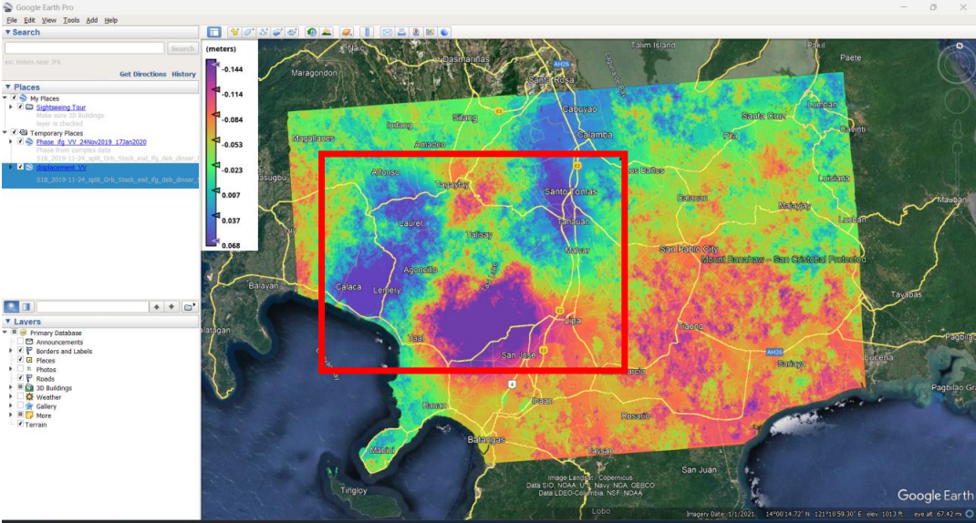
Case Study: Displacement Map for Taal Volcano (Philippines) — 12 January 2020
I selected Taal Volcano and used SAR images from before and after the event. The workflow included:
Workflow
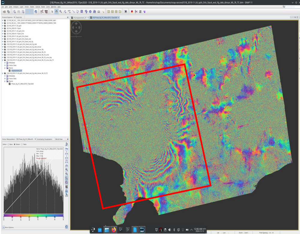
- Co-registration and orbit correction (IW2, VV)
- Enhanced spectral diversity for improved alignment
- Interferogram formation and topographic removal
- Deburst, multi-looking, phase filtering and phase unwrapping (SNAPHU)
- Generate displacement map, terrain-correct and export
Discussion
The interferogram fringes show ground deformation, closer fringes indicate larger surface displacement. After phase unwrapping and terrain correction the displacement map can be interpreted and exported as GeoTIFF for visualization in GIS and Google Earth.